Floods displace over 4,600 households as heavy rains pound the country

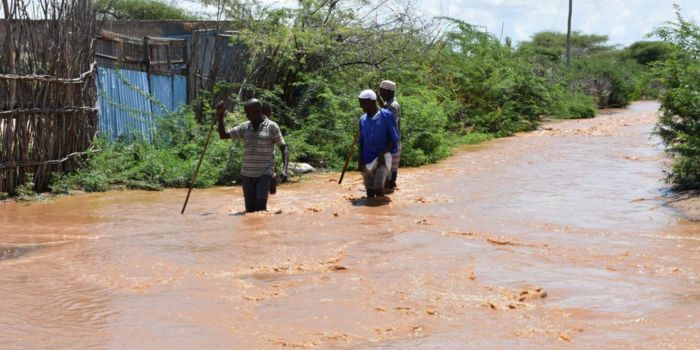
According to the Kenya Red Cross, at least 16 counties have been affected by the ongoing rains.
More than 4,600 families have been displaced due to flooding as a result of the current heavy rains across the country.
According to the Kenya Red Cross, at least 16 counties have been affected by the ongoing rains, resulting in 17,445 households being impacted.
Related Stories
In Nairobi, it was reported that rains that poured over the weekend affected 3,716 families.
The affected mostly reside in informal settlements such as Viwandani, Kibra, Mukuru Kwa Reuben, Mukuru Kwa Njenga and Kawangware.
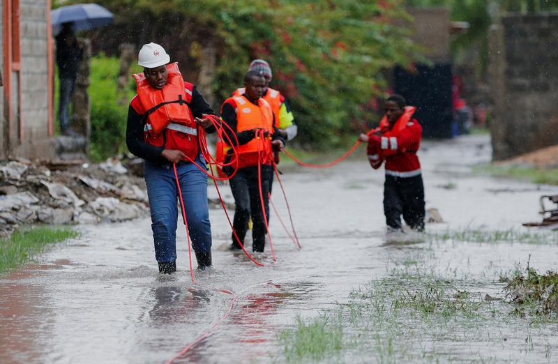
Red Cross said they collaborated with the community to help the affected families.
"The Kenya Red Cross, along with community response teams, helped move trapped individuals to safety and conducted assessments of affected households to initiate the much-needed support," the statement reads.
On Sunday evening, heavy rainfall hit parts of Nairobi. Areas like Embakasi, Lang'ata, Dagoretti South, Dagoretti North, Westlands, and Roysambu experienced rainfall of up to 100 mm.
The weather forecast warned Kenyans across the country to brace for continuous heavy rainfall until Thursday.
David Gikungu, Director of Meteorological Services, stated that the downpour would last until 6 pm on April 18, 2024.
Affected regions
He mentioned that the heavy rainfall would occur over various regions, including the Lake Victoria Basin, the Rift Valley, Highlands West and East of the Rift Valley, Nairobi area, Southeastern Lowlands, Coast, and the northern region.
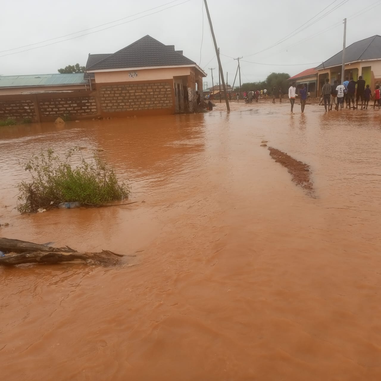
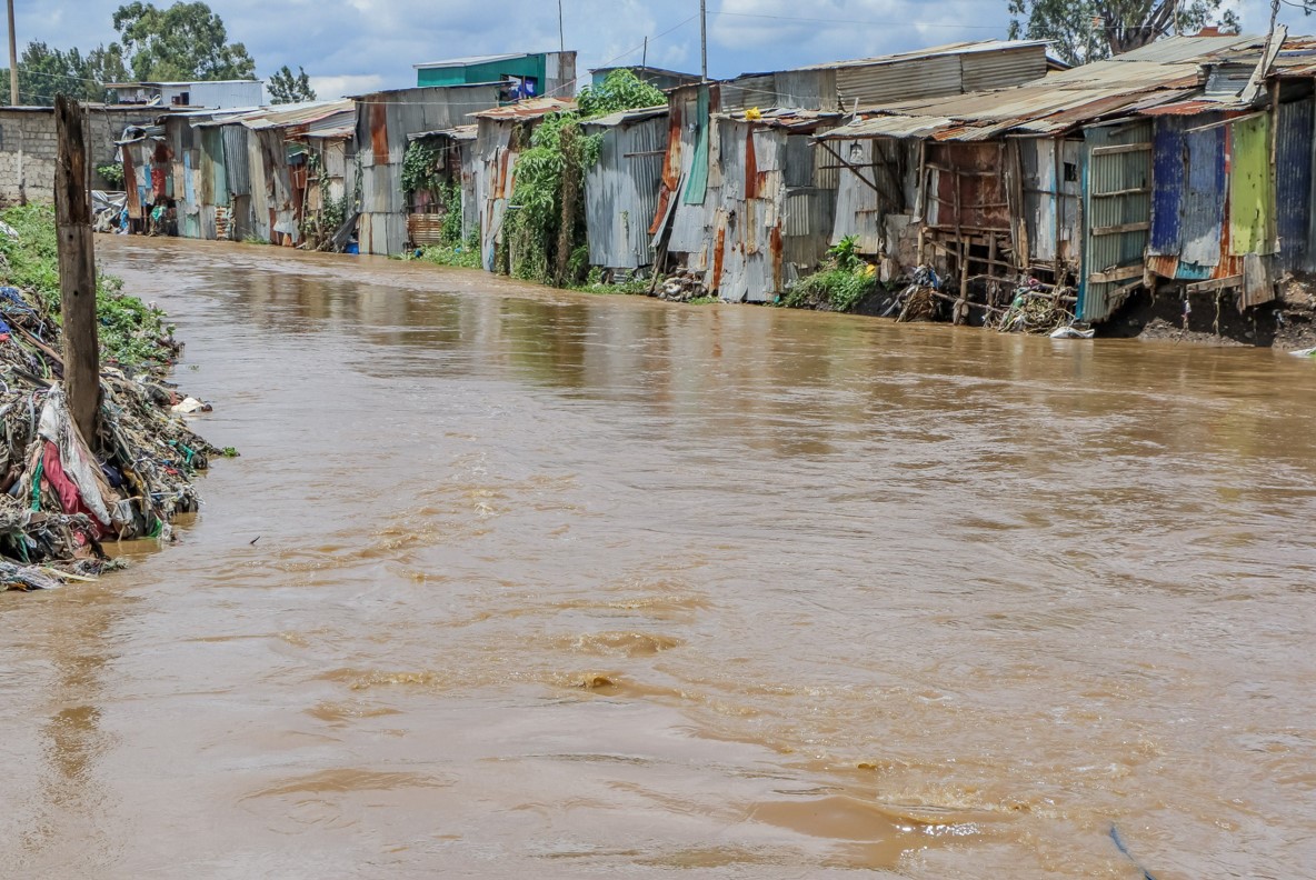 A flooded road in the middle of the Mukuru kwa Njenga slums. (Photo: Kenya Red Cross)
The forecast also indicated that on April 14, 2024, heavy rainfall exceeding 40mm in 24 hours would occur in the Lake Victoria Basin, the Rift Valley, Highlands West and East of the Rift Valley, Nairobi area, Southeastern Lowlands, and South Coast.
He pointed out counties that should be on the lookout for potential floods, flash floods and reduced visibility.
They include Kisumu, Homabay, Siaya, Migori, Busia, Kisii, Nyamira, Nandi, Kericho, Bomet, Kakamega, Vihiga, Bungoma, Narok, Baringo, Nakuru, Trans-Nzoia, Uasin- Gishu, Elgeyo-Marakwet, West-Pokot and Nyandarua.
Others are Laikipia, Nyeri, Kirinyaga, Murang'a, Kiambu, Meru, Embu, Tharaka-Nithi, Nairobi, Machakos, Kitui, Makueni, Kajiado, Taita- Taveta, Mombasa, Tana-River, Kilifi, Lamu, Kwale, Marsabit, Garissa and Isiolo.
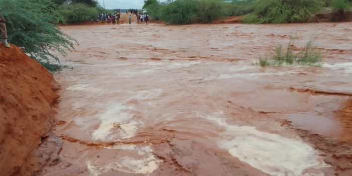
Gikungu noted that floodwaters might unexpectedly emerge, even in areas with minimal rainfall, particularly downstream.
Residents have been advised to refrain from driving or walking through moving water or open fields and it is crucial to avoid seeking shelter under trees or near grilled windows to minimise the risk of lightning strikes.
"Strong winds may blow off roofs, uproot trees and cause structural damages. Large waves may affect marine activities. Updates will be provided promptly if there are any changes," he said.
The Meteorological Department has recently introduced a new mobile application called FASTA (Forecasting African Storms Application) to notify Kenyans about storms.
This app provides live weather updates and displays real-time storm development projections for up to two hours.
Users can choose between two options: "storm regions," which indicate current storm activity areas, and "storm rainfall," which shows ongoing rainfall activity.
This initiative arrives amidst heavy rainfall in the country, which has caused significant damage.
Top Topics This Week
President William Ruto
Vincent Mogaka Kemosi
ruto envoy nominees
ruto envoy appointees
Charles Githinji
isiolo Governor Abdi Ibrahim Guyo
merti floods
isiolo floods
isiolo schools
isiolo mosques
Heavy rains
floods
CS Kithure Kindiki
Kenya Red cross
Tana River
Masinga Dam
Flooding
Floodwaters
Kithure Kindiki
Kenya Coast Guard Service
Trending

Kibra's Nubian community celebrates historic appointment of Maj-Gen Fatuma Ahmed
Yassin Juma
|
1 day ago

Fear grips Garissa,Tana River counties as floods intensify, camp marooned
Issa Hussein
|
12 hours ago

EGYPT-UN-PALESTINIAN-ISRAEL-CONFLICT-BORDER-AID
Dennis Tarus
|
6 months ago

Record-Breaking: Kamukunji grants Sh61 million in bursaries to 9,848 students
Abdirahman Khalif
|
11 hours ago